
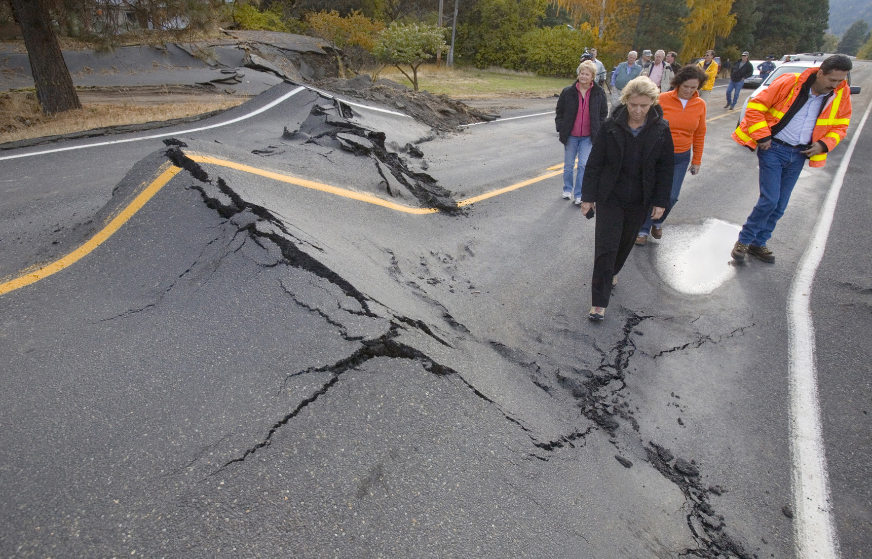
NILE, Wash. (AP) — Nothing is as it was just three weeks ago along this stretch of Nile Road.
Certainly not State Route 410 or the Naches River.
In the place of this once-bucolic scene is a hubbub of activity: Pieces of heavy machinery growl as their operators move earth for a new river channel and to build a new road to replace a temporary, emergency gravel road that soon will be lost to rising water.
When that will happen, only the river knows.
If all goes well — a difficult prospect with winter weather fast approaching — the new channel and the completed road for the winter could see some semblance of peace return around Thanksgiving.
This area of the Nile — with an estimated 300-600 residents — will never be the same again.
For now, the Nile Road is part of the state highway system as a detour for State Route 410.
A permanent route for the scenic highway to Chinook Pass could be at least a year away.
A 50 percent chance exists the Naches River, because of rain and snow, could be flowing at 10 times it current rate of less than 400 cubic feet per second during November.
Rapidly rising flows reaching such high levels would take out the emergency road, an elevated gravel road built on top of the existing Nile Road, cut off the community, and complicate plans to complete the winter road.
All public access was lost for several days immediately after the slide.
County Commissioner Mike Leita said the county’s plan for the new channel will take the river away from the slide and away from the threat of further erosion of the fine-grained slide material that filled the river channel.
Erosion could cause more slides and send tons of silt-laden water down the river to the water treatment plant that the city of Yakima relies on for drinking water.
“If we can keep this together for 10 days to two weeks, we can be successful and not create a separation that will isolate the upper Nile,” Leita said. “We will need that time, if we have manageable weather, to make the complete transition.”
Along the way, the county and the state will spend about $11 million in buying land and building the road.
The county has purchased five properties, displacing three families, for the channel and portions of the road at a total cost of $1.7 million. Staff time and other expenses could see the county’s investment reach $3 million.
Redifer said the money is coming from the county’s Flood Control Zone District account. County commissioners created the district, financed by a property tax of about 10 cents per $1,000 of assessed value, more than a decade ago to fund programs to relieve flood threats throughout the county.
Some county road department funds also are being used.